 |
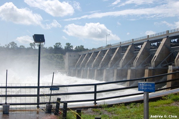
| Gavins Point Dam - Click to Enlarge |
Ironically, the Army Corps' plans for managing the Missouri River's flow have placed it under increased scrutiny by the barge industry, the public and elected officials at a time when the Corps' ability to thoroughly evaluate its management of the complex River system has been limited by Congress.
The Drought and Mississippi River Barge Traffic
 |
| Rock Pinnacles near Thebes Click to Enlarge |
Missouri River Authorized Purposes and Conflicting Water Resource Uses
Multiple users of Missouri River’s water resources (both human and non-human), and the multiple demands those diverse users place (under law) on the Army Corps' water management strategies often come into conflict, and the drought has served to sharpen those points of conflict this year, placing the Army Corps under added scrutiny over how it manages the Missouri River Basin's water for a variety of often-conflicting purposes (what the Army Corps calls “Authorized Purposes” - authorized by the 1944 Flood Control Act (Pick-Sloan Act)). The authorized purposes are (in alphabetic order): fish and wildlife habitat, flood risk management, irrigation, navigation, power generation, recreation, water quality and water supply. Those authorized purposes all are supposed to have equal priority under the law and under the resulting Army Corps management plans. For example, the Army Corps stores additional water in upriver reservoirs beginning in the autumn, so that River water resources may be available later (i.e., in the spring) for some water users who rely upon the River water for its authorized purposes (such as agriculture irrigation, fish and wildlife habitat, downstream Missouri River navigation, power generation and water supplies).
Missouri River Authorized Purposes Study
The U.S. Congress directed the Army Corps to conduct a Missouri River Authorized Purposes Study (MRAPS), the first review of the eight authorized purposes of the Missouri River since passage of the 1944 Flood Control Act. Under MRAPS, the Army Corps would evaluate whether it should still manage the Missouri River based on concepts prevalent in 1944, and then recommend changes to the 1944 Flood Control Act to Congress, so that the River management strategy can be modernized. However, the 2011 massive Missouri and Mississippi River flooding brought with it accusations of Corps' River mismanagement, and Congress barred the Corps from spending any funds toward MRAPS in fiscal year 2012 (which ran through September 30, 2012). Those restrictions are still in place as a result of the fiscal year 2013 Continuing Resolution passed by Congress in September Accordingly, the Army Corps has been forced to suspend MRAPS, at least temporarily. In the meantime, examination of the Corps and its unenviable water resources balancing act continues, along, it seems, with the inevitable criticism that follows.
No comments:
Post a Comment